
February 2026: The Month When It Snowed
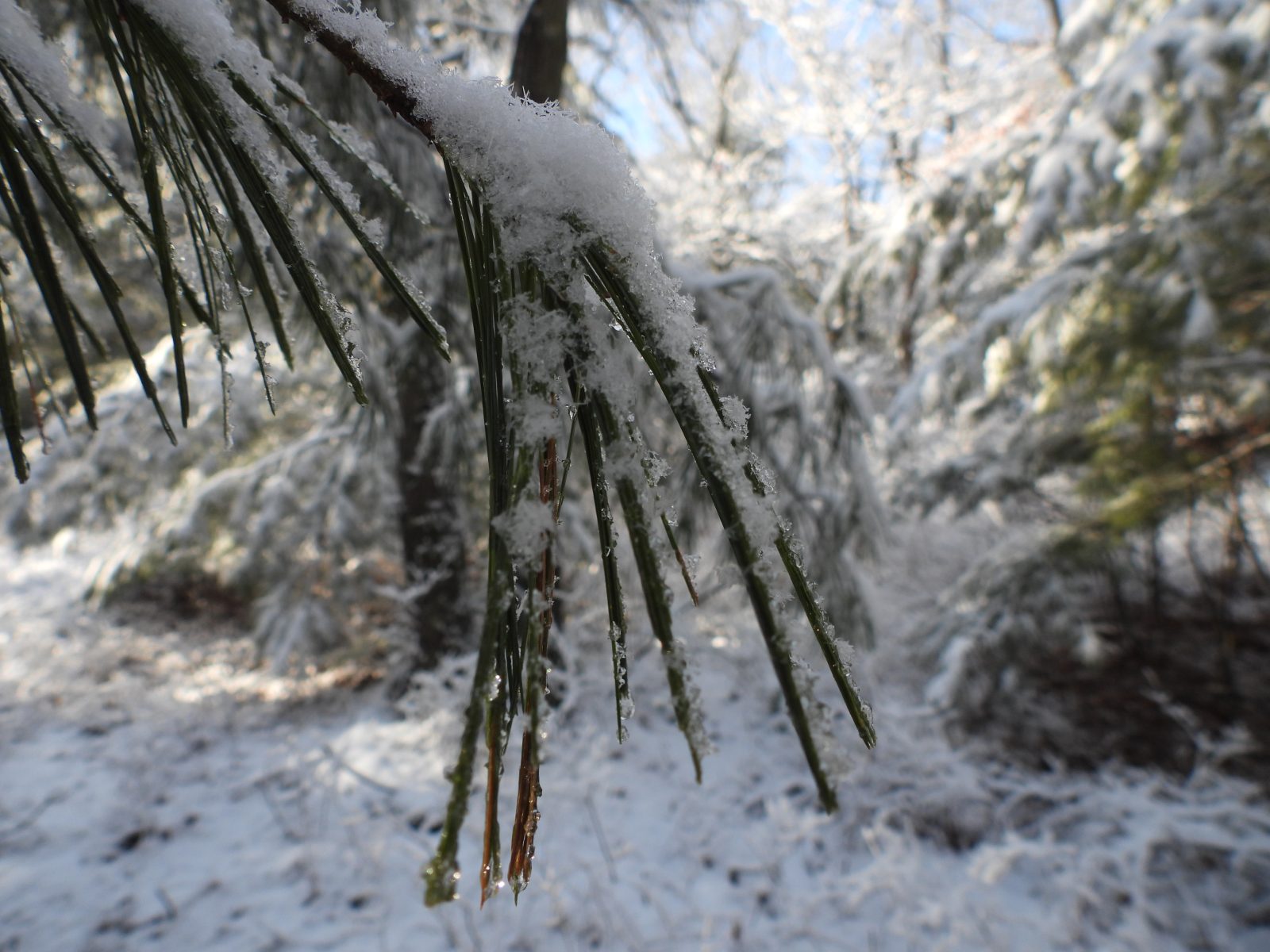
In previous 12 for 12s, I’ve extolled the virtue of hiking after the snow falls. With just an inch or two on the ground, the world takes on a new sheen, glistening in the sunlight, and providing a remarkable contrast for photographers. Dark trees covered by light snow. Colorful birds on canvas-like backgrounds. And with a bit of snow covering everything, you’ve got the closest thing possible to an absolute guarantee that you won’t have to deal with ticks. In January, when we had but one major snowfall, a hike was doable in the following weeks. February, however, has been a different beast. You’ve surely noticed that each weekend, it seems, has seen Long Island hit with at least some snowfall. Just when it seemed like it was all over, and the rain washed away much of the snow, we were hit with the biggest blizzard in years, delivering upwards of two feet of snow across the Island.
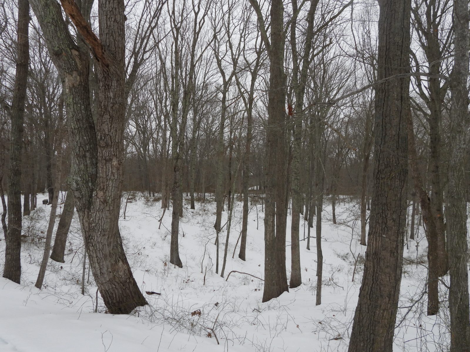
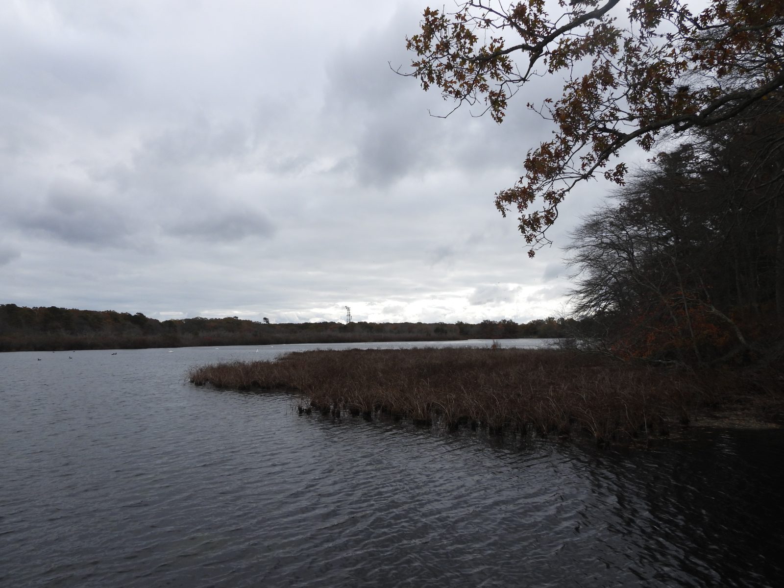
Because the world seems slanted towards irony, it was this week that I’d planned to go hiking for this very post. Now, that doesn’t seem feasible. I did go on hiking this month, though, before the blizzard, and also before the rain that preceded it. It was to Mashomack Preserve, on Shelter Island, and attempting this hike gave me a new perspective on hiking in the snow.
Even though it had not snowed heavily for some weeks, there was still an immense buildup of snow across the whole of the preserve. The exact depth varied anywhere from three to as much as eight inches. Despite slightly above freezing temperatures, the snow was still firm, giving way only when the full weight of my body pressed onto it. This made for a decidedly more difficult hike than the sort I was used to, with only one or two inches of snow on the ground. With an inch or two, there is a satisfying crunch underfoot, but that’s all. It’s a delightful auditory experience that doesn’t impede one’s movements. Three inches or more and suddenly, things change. The snow starts to grip your feet, making each step a much greater effort. Exhaustion seeps in swiftly, and a distance that might normally take fifteen minutes to traverse suddenly takes half an hour. Hiking in deep snow is a workout, and if you don’t have a good pair of boots, or even a pair of high-traction hiking shoes, it can also be exceptionally slippery. So, when faced with deep snow there are two possibilities: either the snow is pliable, and thus sucks you in, making each step a Herculean labor, or it’s frozen over and slippery, meaning you’re at risk of falling. Long story short: hiking in these conditions is dangerous. I’m an experienced hiker, and I wasn’t alone, so I wasn’t at risk. But if you’re less experienced, or you’re alone, there’s a serious danger of falling, hurting yourself, and then succumbing to the frigid weather. It’s a good idea regardless of the conditions to carry a whistle, or some other noise-maker that can alert other hikers to your location, just in case. With so much snow on the ground, though, the likelihood of there being other hikers around is slim, if not nonexistent.
The moral of this month’s 12 for 12 is simple: with snow as heavy as we’ve received, stay indoors. While we’ll always encourage Long Islanders to go out into the Pine Barrens year-round, safety is of the utmost importance, especially when the conditions are as intense as they are now.
By Travis Cutter, Long Island Pine Barrens Society
January 2026: Cathedral Pines County Park
For this first 12 for 12 of 2026, we took a trip to an emblematic Pine Barrens park. Perhaps best known for its campgrounds, Cathedral Pines County Park also hosts extensive trails that wonderfully showcase a mixed Pine Barrens forest. This trip occurred just after a recent snowfall, and few outdoor activities are more underrated than hiking through the fresh snow. Glistening landscapes, drooping fronds, and faint traces of animals’ recent passing-by make for a magical experience, and there was truly no better first impression Cathedral Pines could have made.
Situated in Middle Island, Cathedral Pines County Park possesses an extensive lot for campers, wide open fields that make for a great day of family fun, and (the focus of this review), a sizable network of trails that provide both a good workout, and a good ecological showcase of the Pine Barrens. These trails are relatively narrow and often covered in roots, meaning this is not the place for a casual hike. Frequent changes in elevation, including some of which are quite stark, make for a tougher than average hike, perfect for those of you looking for a decent workout. The trails are also suitable for biking, and on this visit, I saw tire tracks carved through the snow. While this disturbed the pristine beauty of the otherwise fresh-fallen snow, it helped me follow the trail, and served as a good marker. The trails do have markers, but some of these are free-standing, and when covered in a nice inch of snow, they become much more indistinct.
Lest you think that a snow-covered wilderness is bereft of wildlife to enjoy, on this hike I was treated to a nice variety of birds. Some were year-round residents, while others were winter migratory species. A particular highlight was the Red-breasted Nuthatches, one of my favorite migratory species due to their bold coloration and patterning. They have rotund bodies and thick black “eyebrows,” and they make a strange squeaking sound in lieu of chirping or singing. All of this adds up to a unique and delightful birding experience.
If you’re concerned about immersing yourself fully in the ecosystem and thinking that the extensive campground might interfere with that immersion, rest assured it’s very easy to avoid such disruption. Simply continue taking the path leading right, and you’ll be deep enough in the woods that you won’t hear any noise from campers and will be totally immersed in nature. Being consistent with the direction you choose is also a good way to avoid getting lost, as all you must do to get back the way you came is turn around and make the opposite choice (meaning, if you kept taking right turns, take all the left turns instead).
Cathedral Pines County Park was the perfect park to visit in the wake of a light snowfall. Few feelings are better than breathing in the crisp, wintry air, and hearing the snow crunch underfoot. Some are inclined to say that winter is a “dead” season, but a trip through the Pine Barrens proves it’s anything but that. Seeing the fresh footprints of squirrels, and birds singing high in the boughs of tall, old pines, makes for as lively an experience as any summer hike. Whether you’re looking to shed the winter weight or the winter blues, the solution is simple: take a hike in Cathedral Pines!
By Travis Cutter, Long Island Pine Barrens Society
December 2025: Sears-Bellows County Park
Nestled away in Hampton Bays, just south of Hubbard County Park, is a vast Pine Barrens preserve with extensive trails, ample wildlife, and scenic views. Sears-Bellows County Park isn’t the flashiest of preserves, but in addition to the qualities just described, it has enough in the way of facilities to make it a great park for casual fun and serious hiking.
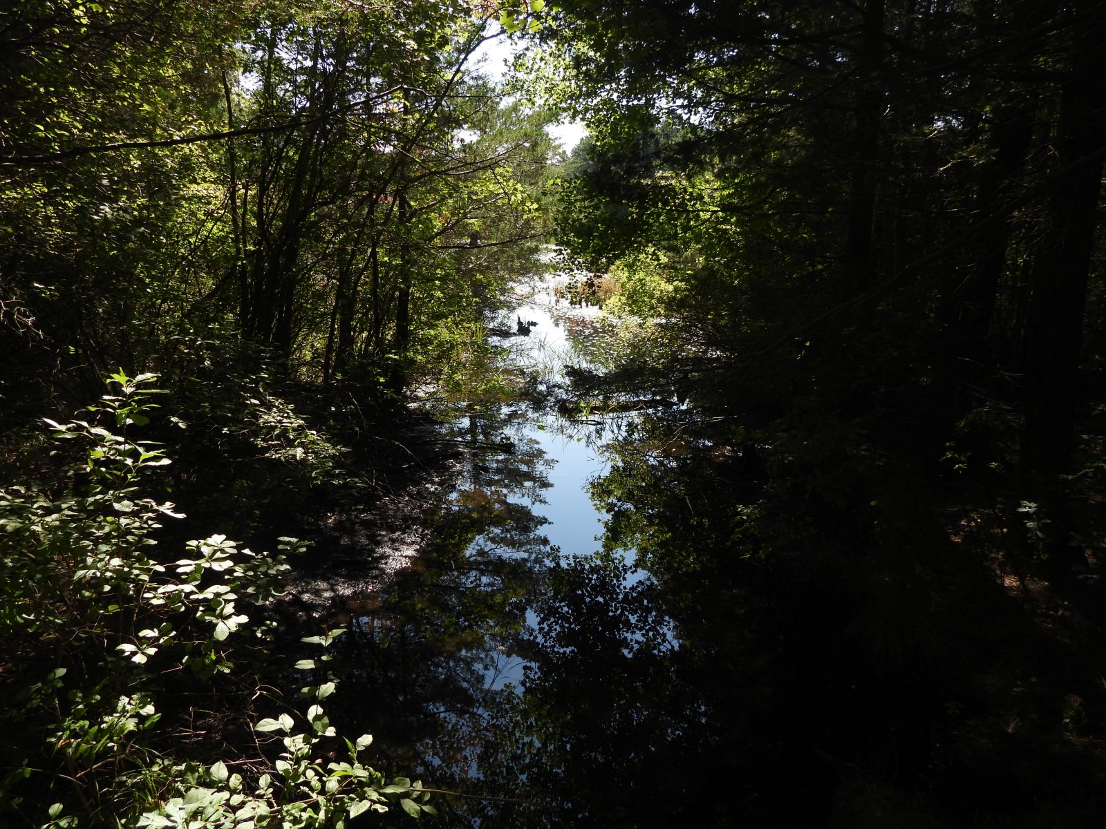
I visited Sears-Bellows on December 18th, only a few days after the first serious snowstorm of the season. Though it had been a few days, and the temperature had risen sufficiently, snow still covered most of the ground. Thanks to the preserve’s wide and decently well-marked trails, though, the snow cover didn’t hinder my navigation of the trails. The whole park runs from east to west, with Bellows Pond at the start of the park, and Sears Pond marking a good place to turn around. The trails keep going after Sears Pond, and the preserve actually is part of the Paumonok Path, but for a regular day of hiking, going between the two ponds which lend the preserve its name is perfectly satisfactory.
In terms of habitat, Sears-Bellows County Park is emblematic of the eastern portion of the Pine Barrens. Dense forest with frequent pond edges (as there’s more than just the two ponds dotting the preserve), make this an ideal birding spot. On my visit, I was treated to some of my favorite winter songbirds, such as the Red-breasted Nuthatch and the Fox Sparrow. These migratory birds are cousins of more common residents, such as the White-breasted Nuthatch and the Song Sparrow, respectively, and make for some nice variety during the colder months. I also was lucky enough to spot a Sharp-shinned Hawk, a bird which is emblematic of the ecological health of the region, as Sharp-shinned Hawks prey upon other birds, meaning their presence is indicative of thriving bird populations. As part of our “The Best of the Rest” initiative, the Pine Barrens Society has identified about one hundred acres immediately adjacent to Sears-Bellows, which we think ought to be preserved. Increasing the amount of preserved land in the region will allow it to remain ecologically healthy moving forward, and we’re thankful that the Town of Southampton has begun eyeing some two-thirds of the parcels we’ve identified. Besides ecological health, preserving this land will also ensure the health of the underlying aquifer, thus providing cleaner, more affordable drinking water for the region.
While it was hard to tell due to the still-thick snow cover, Sears-Bellows County Park possesses extensive parking space. Only a few feet away from the lot is a bathroom facility, though this was closed on my visit (likely due to the snow). In the warmer months, you can rent a kayak for use on the surface of Bellows Pond, which is just beside the lot. There is also a nice playground facility, making this a great place to visit for family fun. However, if you’re looking for a casual hike, this is not necessarily the place. The trails are lengthy and, as far as I could determine, there was not a single bench to rest on, except beside Bellows Pond. Sears-Bellows is great for casual outdoor fun, and for serious hiking, but not for a more relaxed walk through the woods. If you start hiking the trails, know your limits and be comfortable with turning around and going back early if you feel you’ve reached them.
Overall, Sears-Bellows County Park is a great eastern Pine Barrens preserve. Its extensive trails are perfect for the naturalists among you, and during the warmer months especially it’s a great place to get your family outside. It fits in perfectly with the wider system of preserves in Suffolk County and, like so many other preserves, manages to provide a variety of experiences to suit a variety of needs.
By Travis Cutter, Long Island Pine Barrens Society
November 2025: Wertheim National Wildlife Refuge
This month, we’re revisiting Wertheim National Wildlife Refuge. This central Brookhaven preserve contains much of the Carmans River southern watershed and features a pair of trails which surround that crucial fresh waterway. Visiting the park as the weather turns frigid is a great reminder that the beauty of the Pine Barrens is not limited to the warmer months, and Wertheim, in particular, demonstrates the potency of the National Wildlife Refuge system in providing quality educational and recreational experiences that anyone can access.
One of the great benefits of Wertheim National Wildlife Refuge is that it is completely free to access. There is ample parking, especially in these colder months when fewer people are out in nature. The visitor center is well-maintained, staffed by helpful volunteers, full of educational resources, and equipped with high quality bathroom facilities. Again, recall that this preserve is free to access, making these benefits more impressive.
Last time we visited Wertheim, we headed south along the Black Tupelo Trail. This is the trail leading to the left when you’re facing the front door of the visitor center. It runs straight along the river and features a loop at the end, so it is literally impossible to get lost, unless you leave the trail (which we never recommend doing). This time, we headed to the right, where the White Oak Trail takes you across the river, then south again along its western shore. The White Oak Trail is a bit more complex than the Black Tupelo, featuring two loops (the “Long” and “Short loops). While this variability keeps the trail feeling fresh, it can be a bit confusing if you’re new to the preserve and don’t study the maps at the start. Otherwise, this is a great trail, with a wide, gravel path for much of its length, and frequent outlooks onto the river and its surrounding wetland. It’s generally flat, so if you proceed at a measured pace, it’s not going to be a strenuous workout, but the wideness of the trail makes it ideal for running. The western part of the trail, the part that is more distant from the river, is more prone to leaf litter and the trail narrows a bit, so if you’re moving fast and worried about slipping then you should turn around instead of completing the loop.
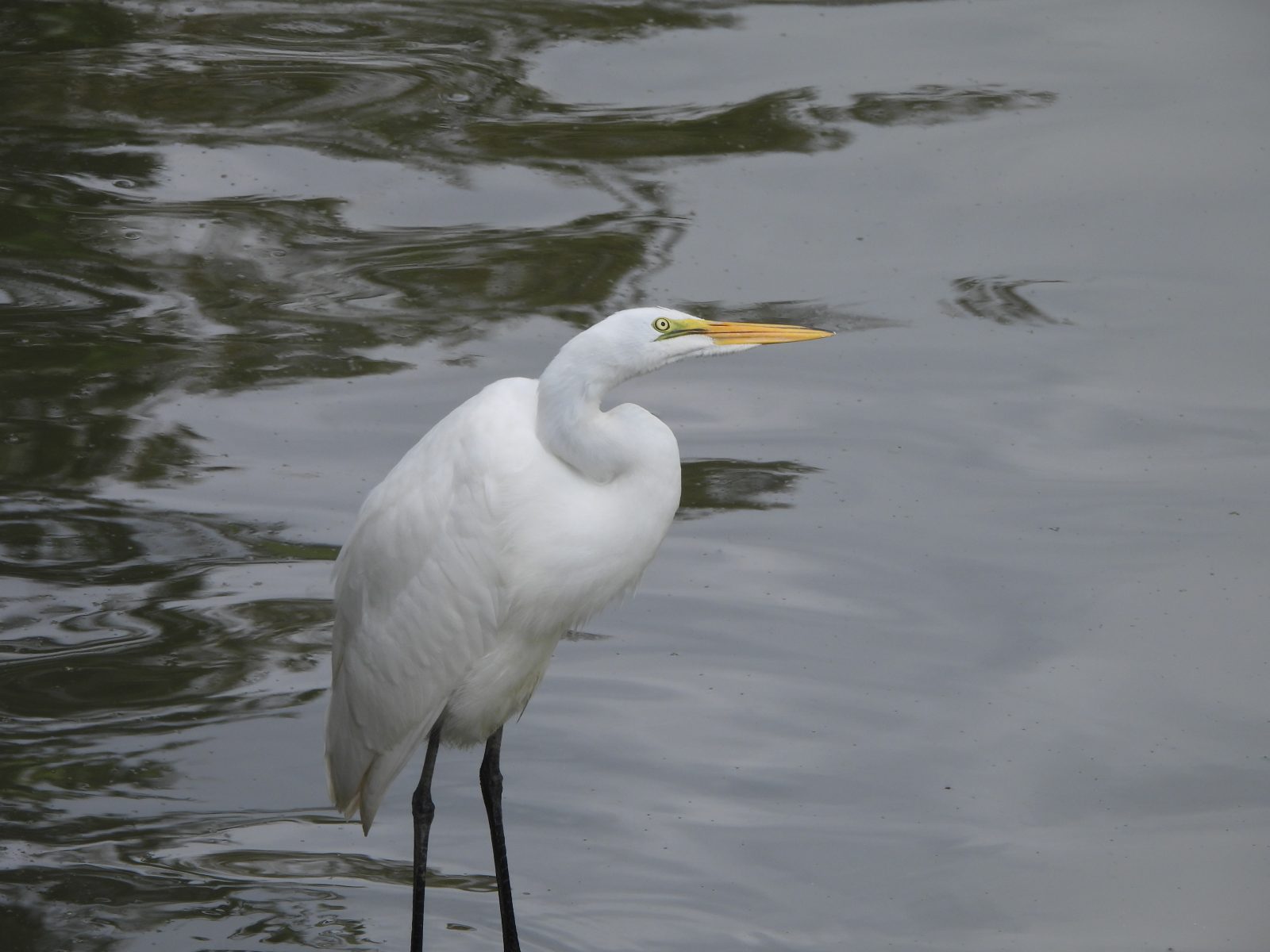
Something we often try to emphasize is that the Pine Barrens is full of life year-round, despite the cold. On this hours-long hike through Wertheim, I spotted a wide variety of critters, including Eastern Bluebirds, Belted Kingfishers, nuthatches, chickadees, squirrels aplenty and even a pair of young White-tailed Deer. The river, too, hosted some wonderful waterfowl species, including a lone Common Merganser which, despite the name, is one of Long Island’s more elusive migratory duck species. With over two dozen species seen across just a few hours, there was little difference in the quantity compared to summertime visits to Wertheim. Of course, there are different species present in different seasons, but that variability only enhances the appeal of a fall or winter walk through the Pine Barrens.
Wertheim National Wildlife Refuge is one of the shiniest gems of the Pine Barrens. Between its accommodating facilities, its extensive trails, and its prime location along one of Long Island’s key ecological fixtures, it is the perfect place to visit year-round, and a true testament to the value of the National Wildlife Refuge system. Whether you’ve been a hundred times, or have never been, it’s always worth visiting.
By Travis Cutter, Long Island Pine Barrens Society
October 2025: Southaven County Park
This month, we’re returning to Southaven County Park, a place that the Society has a long history with. In 1993, it was the place where the Pine Barrens Protection Act was signed into law. And in 2023, it was the site of the Society’s celebration of that pivotal law’s thirtieth anniversary. Thus, for anyone who cares about the history of the preservation of the Pine Barrens, it’s a worthwhile place to visit. Beyond its important place in the Society’s history, though, Southaven stands tall as one of the best parks in the Suffolk County system.
Southaven County Park sits in the core of the Pine Barrens. Situated just north of Wertheim National Wildlife Refuge, it encompasses much of the Carmans River’s watershed. The river is thus a highlight of the park. Whether you’re a naturalist looking to observe some waterfowl, a sportsman looking for a place to fish, or you’re desperate to get out on the water in a kayak or a canoe, this is the perfect park for you. In the warmer months, you can even rent a kayak if you want to try the activity out for yourself. Few places are better for kayakers of any experience level than the Carmans River, as the water is calm, the scenery is often beautiful, and it’s easy to orient yourself since the river runs north to south. It is that orientation that also makes it easy to navigate Southaven County Park. So long as you know where you are relative to the river, you’ll never lose your sense of direction, even on a cloudy, sunless day.
Much like Belmont Lake State Park to the west, Southaven County Park is one I would call a recreational park first and foremost. The parking area is vast, with room for dozens and dozens of vehicles, and there are several wide-open fields with ample seating. Between a playground and a disc golf course, the park encourages play for kids and adults alike. The paths leading to and from these open spaces are wide and easy to traverse, so anyone can enjoy some much-needed time outside.
The trails which criss-cross the park are decently wide and largely flat. I didn’t notice any root-covered areas that made traversal difficult, so if you’re looking for a more laid-back hike, this is a good place to go. My preferred trail here is one which runs parallel to the Carmans River, as the ease at which you can orient yourself makes up for the sporadic trail markings. Despite the trail’s lower level of difficulty, going at a steady pace means you can get a good workout, if that’s what you’re looking for.
Ecologically, the park is an archetypal Pine Barrens forest. During my hike, the Carmans River was populated chiefly by Canada Geese, swans, and a lone cormorant. Throughout the park, the usual songbirds, such as Tufted Titmice and Black-capped Chickadees, made sporadic appearances. There were also some more elusive species, such as the Brown Creeper, a delightful little bird which blends in remarkably with the trees it skitters along, and the Golden-crowned Kinglet, a beautiful little migratory species, which resides on the Island throughout the winter. The park’s accessibility, openness, and proximity to the river provide ample opportunity for education. You can spend a long time studying small areas, and you can see how the habitat subtly shifts as you move to and from the water.
Southaven County Park is a jewel in the county park system. From its sweeping forest to the extensive opportunities for a wide variety of activities, and its significant history, it’s a park that has something for everyone.
By Travis Cutter, Long Island Pine Barrens Society
September 2025: Cranberry Bog Nature Preserve
For as long as there have been human beings, there have been human beings who work hard in opposition to the natural world which we inhabit. Industries of all kinds have resulted in massive ecological changes, many of them harmful, since the dawn of agriculture. Cranberry Bog Nature Preserve is a county park that proves that such historic developments are not the end to a healthy, thriving environment, and that what may seem like a permanent industrial activity may be nothing more than a brief bump in the road towards an ecologically balanced Long Island.
Cranberry Bog Nature Preserve is a county park tucked away in Riverhead. It is technically not a “natural park,” a fact which can be deduced from its name. Nearly a century ago, it was the site of a cranberry farm, at a time when that was a thriving industry on Long Island. The pond, which is a central fixture of the preserve, was created by the farmers to supply water to the farm. Other remnants of the preserve’s former life are scattered throughout the park, such as a section of forest with no underbrush (as it had long ago been cleared and only in recent years has been allowed to grow back), as well as the ruins of an old pump house, and part of the trail.
And yet, were you unaware of this history, it would be hard to deduce from the park alone that it was not natural in origin. Cranberry Bog is a paradise for a remarkable variety of animals, including snakes, turtles, frogs, herons, and even some of Long Island’s rarer specimens, such as the elusive Black Vulture. A handful of benches are strategically placed around the main pond, allowing you to rest and absorb the beautiful scenery. At this time of year, in the midst of the fall bird migration, you’re likely to see a good handful of warblers, such as the Common Yellowthroat and American Redstart.
Besides the handful of benches, Cranberry Bog’s trail is fairly accessible. It’s often wide, often sandy, and there are a couple of wooden bridges. One portion of the trail is covered in extensive roots, so you’ll have to be careful there. This is not a preserve that is readily accessible to those of you who use wheelchairs, crutches, or other mobility aids. Neither is it a preserve that is exclusively for hardcore hikers. Besides the one root-covered section, the trail is flat and easy on the feet. The most difficult thing when it comes to Cranberry Bog is not the hike, but finding a parking space. At best, there is room for four small cars packed very closely together. Three cars can fit comfortably. So, when driving in, be considerate, careful, and patient.
Don’t let the name fool you, Cranberry “Bog” Nature Preserve is a beautiful place. With a relatively easy trail through extensive woodland and around a shimmering pond, it’s sure to delight and calm those of you looking to escape the gray, concrete world we’ve built for ourselves. Populated by a wide variety of species, including some rarer specimens, it provides an enticing day in the Pine Barrens for any naturalist. And, perhaps most significant of all, the history which still marks the preserve stands as a testament to the impermanence of even the most dominant, destructive industries. It’s never too late to undo the damage we’ve caused and in doing so create a core part of the people’s park.
For more on this preserve, stay tuned for our upcoming 48th Anniversary Gala, which will premiere on our Facebook page and YouTube channel on Thursday, October 23rd at 7 pm. That event will feature an extensive exploration of Cranberry Bog, as we highlight the importance of Preserving the People’s Park.
By Travis Cutter, Long Island Pine Barrens Society
August 2025: Frank Melville Memorial Park
Sometimes, you don’t have the time to go for a long trek through the Pine Barrens. Sometimes, you don’t want to have to worry about ticks. Sometimes, you’re incredibly busy preparing for an anniversary gala. When one or all of these things are true, but you still want to get outside and enjoy some of Long Island’s natural beauty, you need to visit a place like Frank Melville Memorial Park.
Frank Melville Memorial Park is unusual in that it’s not owned and operated by any governmental body. Instead, it’s a private park, open to the public and owned by the Frank Melville Memorial Foundation. This aspect of the park gives it a unique aspect, as the park is not only a nature preserve comprising over twenty acres of forest and pond habitat, but it also includes some historic buildings. This gives a walk a different flavor, for lack of a better word, when compared to other preserves, and if you appreciate Long Island history it’s a wonderful addition.
While the park itself does not have an especially large parking lot (the capacity is about half a dozen cars), there is ample roadside space in the area around the park, plus well-marked crosswalks, making it easy to access. Regarding the trails, there are two main areas, a roughly half-mile trail around a pond which is completely paved and dirt trails that head deeper into the surrounding forest which are wide, but which are best tackled if you’re properly dressed to avoid ticks. If you want a stress-free visit, stick to the main loop around the pond and enjoy a couple of laps around. It’s perfect for a workout or a casual stroll, and bicycles are permitted only on these paved paths. Benches are placed periodically, allowing you to sit and enjoy the song of the goldfinches which fly above, or the dance of the swallows flitting around the surface of the pond.
Something immediately apparent about Frank Melville Park is that it’s exceedingly popular with dog-owners. There were at least a dozen furry friends going on walks within a single hour. This makes it a great place to bring your own canine companion or anjoy a more social experience. Opening a conversation with the question “Can I pet your dog?” and the answer, “Yes you can!” can make for a thoroughly enjoyable experience. However, the level of noise that results from numerous dogs walking along a short path means that this is not the best place for thoughtful contemplation, or a study of the local wildlife.
Frank Melville Memorial Park is the perfect place for a social stroll, a quick workout, or a walk with your dog. Its healthy mixture of well-kept habitat, ample seating, and paved trails makes it perfect for nature lovers of all levels of ability. Situated near the historic areas of Setauket, and possessing historic structures of its own, means there’s a lot for lovers of Long Island’s heritage to enjoy. Though it’s a privately-owned preserve, it perfectly fills a gap left by some public parks, and that it is a publicly-accessible park is a great gift to all Long Islanders.
By Travis Cutter, Long Island Pine Barrens Society
July 2025: Smith Point County Park
It’s the middle of summer which means it’s hot, we’re months away from the next songbird migration, and ticks are aplenty. So, what’s better than a day at the beach? Smith Point County Park comprises a large stretch of the Fire Island coastline in the Town of Brookhaven. Thus, unlike many of the south shore’s beaches, the water here is actually part of the Atlantic Ocean proper, not the Great South Bay. The position of Fire Island as a barrier island results in some interesting habitat, and plenty of opportunities for activities beyond the typical beach-going fare.
Of course, we have to start this post by bringing up the most important consideration when deciding if you want to visit Smith Point: it costs money to park your vehicle! Either you pay on arrival for a one-time use, or you can buy the County Parks’ Green Key pass to access this and other parks. Once you’re in the park, there’s ample parking. If you’re interested in camping out on the beach, there’s plenty of space available for mobile homes and RVs, though if you’re looking for an authentic wilderness experience this isn’t the place to camp. RVs and mobile homes are packed so close together that it feels less like a campground and more like an ad hoc, miniature city.
Smith Point County Park is a beach, and so, of course, you can do all of the things you expect to be able to do on the beach. Hop in the water, soak up some rays, fly a kite, toss a frisbee, read a book, et cetera, et cetera. If you want a quality beach, this is a great option. But Smith Point is also a county park, and so the question arises: can you engage in the typical park activities here?
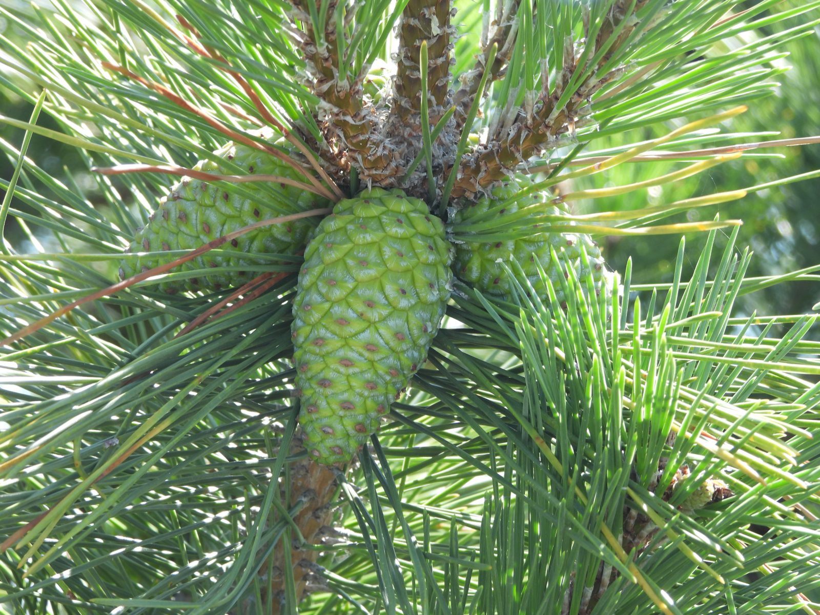
When it comes to hiking, Smith Point offers the beach, sporadic boardwalks, and paths where trucks are allowed to drive in the area around the RVs. There’s extensive wild habitat, from grassy dunes that are the nesting site of Piping Plovers and Least Terns, to vast swaths of pines. Thanks to the proximity of the pines to the boardwalks, you can examine these and other plants up close.
The unique habitat offered by dunes also offers up some unique fauna relative to many of Long Island’s inland parks. As mentioned, Piping Plovers and Least Terns nest all throughout the park, though on this visit I unfortunately couldn’t spot any of either. Gulls of several species are all over, including the magnificent Great Black-backed Gull, the largest species in the world, which is less common the further inland you go. In the flat, grassier areas near the campgrounds you can spot plenty of Killdeer, a unique species of plover that prefers terrestrial habitats.
When visiting the county park, you can also take some time to head over to the Fire Island National Seashore Visitor Center. This tower overlooks both Smith Point and the National Seashore, and is filled with numerous educational aids for people of all ages. At the base of the center sits a piece of a whale’s skull, giving an illuminating sense of the vastness of living creatures. As with the novel habitat of the county park, the visitor center allows for unique educational experiences for those who want to pursue their curiosities outdoors.
When looking at the totality of Long Island’s many national, state, county, and town parks, one has to remember and value the diversity in the locales that are included in the overall preserve. It is thanks to the collection of a wide variety of habitat, and a wide variety of recreational opportunities, that Long Island can possess a healthy, vibrant environment. Smith Point County Park offers plenty of recreational value, with all the usual beach activities as well as ample space for fishing, camping, and biking. It also provides a window into an interesting, essential habitat, with the potential to observe unique and/or at-risk species. The nearby visitor center provides even more in-depth information on the local flora and fauna, and the park has clean, accessible restroom facilities. If you don’t mind paying the monetary cost of admission, it’s the perfect place to spend a summer day.
By Travis Cutter, Long Island Pine Barrens Society
June 2025: Shorefront Park

This month, our 12 for 12 hike is to a location a little different than usual. While this series has covered parks and preserves along Long Island’s shores, small parks and preserves, and new parks and preserves, it’s never covered a place quite like Shorefront. Shorefront Park lies at the end of Rider Avenue, just south of downtown Patchogue Village. At a glance, it seems quite pithy compared to any of the other locales we’ve covered, but a closer study reveals a park that is of titanic importance.
What makes Shorefront Park stand out amongst the many parks and preserves around Long Island is the fact that it is a “living shoreline.” You might point out that any preserve that sits on the coast is a living shoreline, and that’s technically true, but what that term means is a bit different when looking at this park. Nearby residences and businesses are clearly visible from Shorefront Park. All you have to do is turn a little bit one way or the other, and you’ll see plenty of development. Then, you turn back to the park, and you see a lengthy stretch of natural grassland and marsh, protected from Patchogue Bay only by a long line of rocks.
How did this formation come to be? One might think that it’s natural, but it was in fact carefully engineered to mimic nature. Just a few years ago, there was an aging wooden bulkhead that performed less-than-admirably in trying to prevent flooding from the bay. At that time, the Patchogue Village community made a decision to try something new: a living shoreline. The line of rocks was in fact carefully engineered to be the right height and material to prevent flooding, and the rocks used have the right shapes to be modular. Should a higher wall be needed, more rocks can be added. Within the rocks, there’s a vast array of native grasses, leading to a salt marsh and the Little Creek, which was widened and extended so it actually connected to the bay. This habitat, and the field behind it, is host to a diverse array of flora as well as fauna – from Red-winged Blackbirds, to Killdeer, to Green Herons – and makes for a very pleasant sensory experience as you walk along it.
It’s not just pretty scenery and wise policy that you’ll find at Shorefront Park. Mascot Dock, which lies just beside the park, is a prime fishing spot, with several people casting lines during my visit. On the edge of the park, between it and the dock, there’s a kayak launch, and despite the rainy weather the water was calm, and people were taking advantage of that fact. Shorefront Park, is not too far from the Carmans River, and so if you’re looking for a good workout (plus a chance to see the whole of the living shoreline from a new angle) why not head east and visit one of Long Island’s primary watersheds? Just be sure to wear a life vest!
Shorefront Park is not a long walk, perhaps ten minutes from end to end at a measured pace, but it is one of the most insightful walks you can have on Long Island. If you live in a coastal community and have noticed the aging flood infrastructure, visit Shorefront Park. See the novel, progressive, environmentally conscious solution to an age-old problem, and bring it back to your community. At Shorefront Park, one can see a future where Long Island is bordered not by ugly construction projects, doomed to decay and fail, but by living shorelines which use the principles of nature to achieve the same end more efficiently. Projects which make Long Island not just safer, but also greener and more beautiful are no-brainers, and if you visit Shorefront Park, I think you’ll agree.
By Travis Cutter, Long Island Pine Barrens Society
May 2025: Hubbard County Park

This month, we headed out to Hubbard County Park, the place “Where the Pine Barrens Meets the Sea.” If that rings a bell, then you must be an avid viewer of our TV show! Hubbard County Park is the location featured in the episode just mentioned, which will be returning to Cablevision’s Public Access channel, starting in June. If you tune into the episode and think to yourself, “Gee, I’d love to go there,” then this review is for you!
Hubbard County Park is tucked away at the northwest corner of Hampton Bays, just a few minutes from either that downtown, or Riverhead’s. The entrance to the park is quite well concealed, but if you follow the directions on the park’s official website (https://suffolkcountyny.gov/Departments/Parks/Our-Parks/Hubbard-County-Park) you should be able to find it without too much hassle. Parking is minimal, but there’s enough space on the roadside to fit most vehicles. A gate blocks entry for anything but foot traffic, and though you could maneuver a bicycle through here, this is not the place for biking. Nor is it suited for anyone on crutches or in a wheelchair. Hubbard is one of the wilder parks we’ve visited in this series, and that lack of curation unfortunately means a lack of accessibility. This is a place meant only for proper, real-deal hiking.
The thing you’ll notice when first stepping past the gate, however, is that what you’re walking on looks quite a lot like a road, or even an extended driveway. It’s not paved, but it’s wide. This makes for a stress-free strolling experience, as the wide dirt trail is as tick-free as possible. Dense forest on either side hosts numerous squirrels, chipmunks, and birds, with the highlight of this trip being the Great Crested Flycatcher, a striking migratory bird with a distinct, frog-like call.
Eventually, the long, straight driveway-like trail will lead you to an actual driveway. A large house stands in the center of the preserve, and this is a private residence so please don’t trespass. The house, I understand, is home to someone who works as a sort of caretaker for the park, but it is in no way a visitor center. I’ll take this moment to note that there are no restroom facilities at Hubbard, so do all your business before you make the trip out here.
Just past the private residence is a sign marking the continuation of the trail. You’ll notice here that the trail is covered in thick, ankle-high grass and, yes, this means exactly what you think it means. Ticks are aplenty from here on out, so be sure to pull your socks up high, and apply some extra spray if you’ve carried it with you. Staying in the middle of the trail will help, as will constant mobility, but with how dense and grassy the trail is you’re almost guaranteed to get at least one on you at this time of the year.
If you brave the ticks, though, your reward is a truly remarkable ecological phenomenon. The farther along you walk, the more the forest thins. Tall grass sets in, and the soil becomes more moist, almost muddy. And, finally, you come emerge at the water’s edge. Flanders Bay is vast and positively gorgeous, with an Osprey nest right at the start, and a trail that can lead you further out. This was where I turned back, however, I was not as equipped for the excess of mud as I thought I was. With all the rain that had fallen in the week prior, this part of the park was likely muddier than usual. Still, if your hope is to go as far out as you can, it’s a good idea to put on some good boots.
Hubbard County Park is one of the wildest parks on Long Island. It’s an ecologist’s dream, as you can see the transition from forest, to marsh, to bay, and all the flora and fauna that come with it. The trail is a straight shot from one end to the other, with only a single fork in the road early on, making it nearly impossible to get lost. So long as you’re prepared to deal with a handful of ticks, you’re in for scenic views, some delightful critters, and a nice bit of exercise, too!
By Travis Cutter, Long Island Pine Barrens Society